


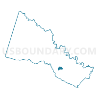
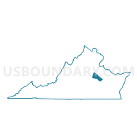
Shady Grove Voting District, Hanover County, Virginia
About
Outline

Summary
| Unique Area Identifier | 681802 |
| Name | Shady Grove Voting District |
| County | Hanover County |
| State | Virginia |
| Area (square miles) | 1.65 |
| Land Area (square miles) | 1.65 |
| Water Area (square miles) | 0.00 |
| % of Land Area | 99.78 |
| % of Water Area | 0.22 |
| Latitude of the Internal Point | 37.65912100 |
| Longtitude of the Internal Point | -77.36502820 |
Maps

Graphs
Select a template below for downloading or customizing gragh for Shady Grove Voting District, Hanover County, Virginia


Neighbors
Neighoring Voting District (by Name) Neighboring Voting District on the Map
- Clay Voting District, Hanover County, VA
- Georgetown Voting District, Hanover County, VA
- Rural Point Voting District, Hanover County, VA